UP Cebu FireCheck hazards maps help Lapu Lapu City firemen
By: Eldan Sambatyon
|
Published on: February 3, 2020

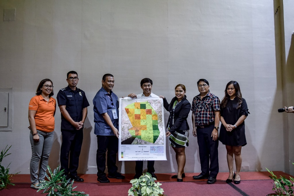
The FireCheck mapping aims to advance the barangays to become resilient against fire and hazards. Photo from DOST-PCIEERD.
The University of the Philippines (UP) Cebu developed a FireCheck hazard mapping that will now help Lapu Lapu City firemen prevent uncontrolled widespread of fires especially in high-density communities.
The Urban Fire Hazard Mapping and Fire Spread Modeling (Firecheck) Project turned over on January 29, 2020, to 19 mainland barangays and the local fire agency officials of the city government of Lapu-Lapu the following:
- 3D maps of high risk communities
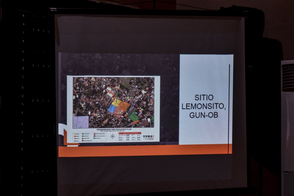
- evacuation plan
- city fire risk maps
- fire spread models and simulation to provide predictive information on the possible extent of the fire and its potential damage and help firemen determine the best course of action during a fire disaster
- mobile application called “Blaze”, a Waze-like navigation app for firefighters to help facilitate speedy navigation and response around highly congested urban areas
The FireCheck mapping, recipient of the Special Recognition in Digital Innovation at the 7th PropertyGuru Philippines Property Awards 2019, aims to make the barangays become more resilient against fire and hazards.
The Firecheck Project took about two years of development with intensive research before it turned over the fire hazard and risk maps and evacuation plans.
FireCheck, a project funded by the Department of Science and Technology—PCIEERD (DOST-PCIEERD) and implemented by the University of the Philippines Cebu under the umbrella of the UP Cebu Central Visayas Center for Environmental Informatics, was turned over by the UP Cebu team to the local city government ahead of the anticipated dry summer season which brings with it the potential fires.
FireCheck is the first of its kind in Cebu and was developed in collaboration with Bureau of Fire Protection- Lapu-lapu, Cebu Planning and Development Office, and the Lapu Lapu Disaster Risk Reduction and Management Office.
Is your area FireChecked?

Lapu Lapu City has been FireChecked. Photo from DOST PCIEERD.
FireCheck maps out fire hazards and possible directions where the flames may go. This can help authorities outmaneuver and prevent the spread of fire.
March, one of the hottest months of the year that mark the beginning of summer season in the Philippines, is also one of the months with the most alarming fire incidents in the country, based on data by the Bureau of Fire Protection (BFP). The month was thus declared by Proclamation No. 360 in 1986 as the “Fire Prevention Month” or “Burn Prevention Month”to raise awareness on the causes, hazards, and dangers of fire.
Due to high and dry temperatures, many areas across the country are considered fire-prone and have the potential of causing widespread uncontrolled fires especially in the clustered communities in both rural and urban areas.
FireCheck seeks to provide emergency fire responders, officials, strategic planners, and policy-makers with information for fire disaster assessment and risk evaluation that helps them prepare, combat, mitigate, and prevent fires and their terrible effects.
What does FireCheck exactly do?
UP Cebu professor and FireCheck Project Leader Aileen Joan Vicente said FireCheck’s hazard maps identify highly-dense residential areas in the cities and other areas that are prone to fire incidents considering the construction materials used in the area, building density, and urban heat island.
Vicente added that besides the hazard maps, her team also created 3D maps of high-risk communities and fire spread models and simulation that can provide predictive information on the possible extent of the fire and its potential damage.
Prof. Vicente said that information from these maps, models, and simulations can be used to improve pre-fire plans, evacuation plans, and investment plans for firefighting facilities and mitigation plans.

The turnover ceremonies is graced by Lapu-Lapu City Mayor Junard Chan, UP Cebu Vice Chancellor Dr. Weena Jade Gera, DOST VII Asst. Regional Director Engr. Jesus Zamora Jr., and Lapu-Lapu City Fire Marshal Supt. Crispulo Eusebio Jr. Photo from DOST PCIEERD.
The UP Cebu professor said “It is now high-time that not only Metro Cebu, but also the whole country, take a scientific and proactive approach to fire disasters based on adequate preparedness, prevention, and mitigation, ensuring that the fire will be put out even before it begins.”
DOST-PCIEERD Executive Director Dr. Enrico C. Paringit expressed confidence that the project will greatly benefit fire authorities in mitigating and controlling damage with the use of modern technology.
“With FireCheck, we can provide a smart solution in increasing the community’s resiliency against fire disasters. We look forward to the day that FireCheck spreads across the nation and ignites the consciousness of our Filipino people in using technology to outsmart natural and man-made disasters,” Dr. Paringit added.
The University of the Philippines Diliman had recently allowed open access to its Light Detection and Ranging (LiDAR) portal on the Taal Volcano to help hasten rehabilitation efforts, marking the first time an Asian country has practiced such open data policy.
UP scientist Mahar Lagmay of the UP Resilience Institute had also recently released netizen-friendly educational material on social media about the Taal Volcano eruption.
The UPRi was also called upon to bring UP experts to help in earthquake-stricken areas of Mindanao.
SEND CHEERS in the comments below to UP Cebu and the people of Lapu Lapu City for this milestone project that can help prevent the spread of fire in the city!
Want to know how to be a Proud Pinoy? Like, Follow, Subscribe to GoodNewsPilipinas.com and our socials Facebook, Twitter, Instagram, Good News Pilipinas! TV on YouTube, for new story notifications and e-mail newsletters for updates on more Filipino Pride stories.