
by Eldan Sambatyon | Feb 3, 2020 | Good Tech
The University of the Philippines (UP) Cebu developed a FireCheck hazard mapping that will now help Lapu Lapu City firemen prevent uncontrolled widespread of fires especially in high-density communities. The Urban Fire Hazard Mapping and Fire Spread Modeling...

by Angie Quadra-Balibay | Jan 31, 2020 | Good Tech
The University of the Philippines (UP) has allowed open access to its Light Detection and Ranging (LiDAR) portal on the Taal Volcano to help hasten rehabilitation efforts, marking the first time an Asian country has practiced such open data policy. The Taal Volcano...

by Eldan Sambatyon | Jan 30, 2020 | Good Balita
A regional evacuation center has been completed in Quezon City and now stands as a model for other evacuation centers all over the country. The Department of Public Works and Highways (DPWH) announced on January 29, 2020, the completion of a four (4) storey evacuation...
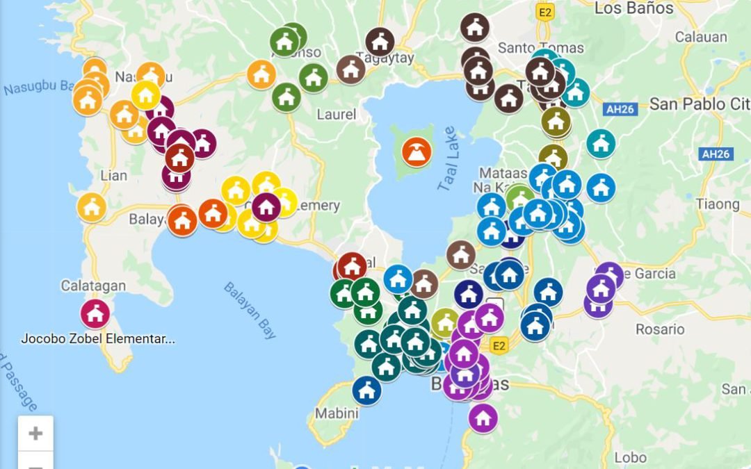
by Angie Quadra-Balibay | Jan 16, 2020 | Good Tech
Google Philippines has just released a consolidated map of centers with regards the Taal Volcano eruption for people who need to find shelter or want to send help. The consolidated map directs viewers to relevant locations for the following: Taal Volcano Eruption...

by Angie Quadra-Balibay | Sep 6, 2019 | Good Tech
Four scientists from De La Salle University – Dasmarinas (DLSU-D) in Cavite have discovered how native Philippine squid can help with disaster management tools for addressing water pollution. In an exclusive interview with the science research faculty team of...
