Phivolcs launches apps to inform Filipinos of natural calamity risks
By: Angie Quadra-Balibay
|
Published on: July 10, 2019

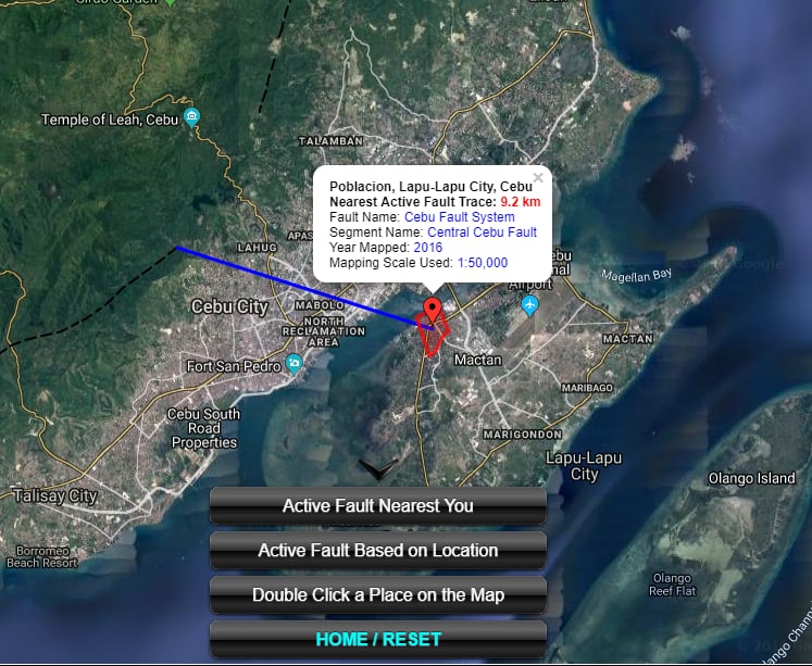
Like the Phivolcs DOST Faultfinder which helps the public track faultlines in their areas, the new disaster risk reduction and mitigation apps will provide real-time information. Credits to Phivolcs DOST.
The Philippine Institute of Volcanology and Seismology (Phivolcs) is launching applications that would help Filipinos know if their location is at risk for volcanic eruptions, tsunamis, and other hazards.
Phivolcs director Renato Solidum announced the new disaster risk reduction and mitigation mobile apps they will use to inform the public:
- GeoMapper-Exposure Data Mapper
- GeoMapper-Situation Data Mapper
- Geo Analytics
- HazardHunter PH
These Phivolcs apps were developed under the GeoRiskPhilippines Initiative project of the Department of Science and Technology.
Among the four apps, only the HazardHunter would be accessible to the public, as the other three were made for government agencies’ use.
HazardHunter will be launched on July 16 and can be accessed either through a computer or mobile phone.
Apart from informing people about risks of volcanic eruptions, tsunamis, and other hazards, the HazardHunter is also helpful for businesses or those planning to put up establishments, since they would find if the area they are eyeing is at risk.
The three other apps were made for government use, as they target to collect exposure data. The GeoMapper-Situation Data Mapper, for instance, will be used by the Office of Civil Defense.
Phivolcs DOST already has 3 information tool apps in use: the Faultfinder, LAVA for volcanoes, and REDAS for earthquake assessment.
TELL US in the comments below if you know of an area that should be on the hazard warning app.
Like, Follow, Subscribe to GoodNewsPilipinas.com Facebook, Twitter, Instagram, Good News Pilipinas! TV on YouTube, new story notifications and e-mail newsletters for updates on more Filipino Pride stories.