University of the Philippines opens portal on Taal Volcano data, 1st in Asia to offer public access
By: Angie Quadra-Balibay
|
Published on: January 31, 2020

Sample hillshade visualization of the Tall Volcano Island (2017). Image from UP TCAGP.
The University of the Philippines (UP) has allowed open access to its Light Detection and Ranging (LiDAR) portal on the Taal Volcano to help hasten rehabilitation efforts, marking the first time an Asian country has practiced such open data policy.
The Taal Volcano LiDAR datasets were derived through the use of airborne systems mounted on an airplane. The output of the LiDAR sensor is a 3D point cloud containing points that were scanned.
The LiDAR technology was able to generate maps with resolution of up to 1×1 meter which can be used for planning and reconstruction of areas damaged by the Taal Volcano eruption in Batangas on January 12, 2020.
The Taal Volcano mapping is free and downloadable by anyone with internet access and by most modern GIS software.
LiDAR Data for Disaster Risk Reduction Planning
In their report “Open Access of Lidar Data for Taal Eruption Affected Areas” released on January 28, 2020, the UP Training Center for Applied Geodesy and Photogrammetry (UP TCAGP) said it is opening its portal to help provide data needed for disaster risk reduction planning and operations.
UP TCAGP Assistant Professor Mark Edwin A. Tupas stressed the importance of using data in conducting planning and reconstruction activities in the areas affected by the Taal volcano eruption.
“With the Philippines being at constant risk from natural disasters, adequate data is needed for disaster risk reduction planning and operations, we are opening up our LiDAR map database to help in the rehabilitation of those affected by the Taal volcano eruption,” Prof. Tupas said.

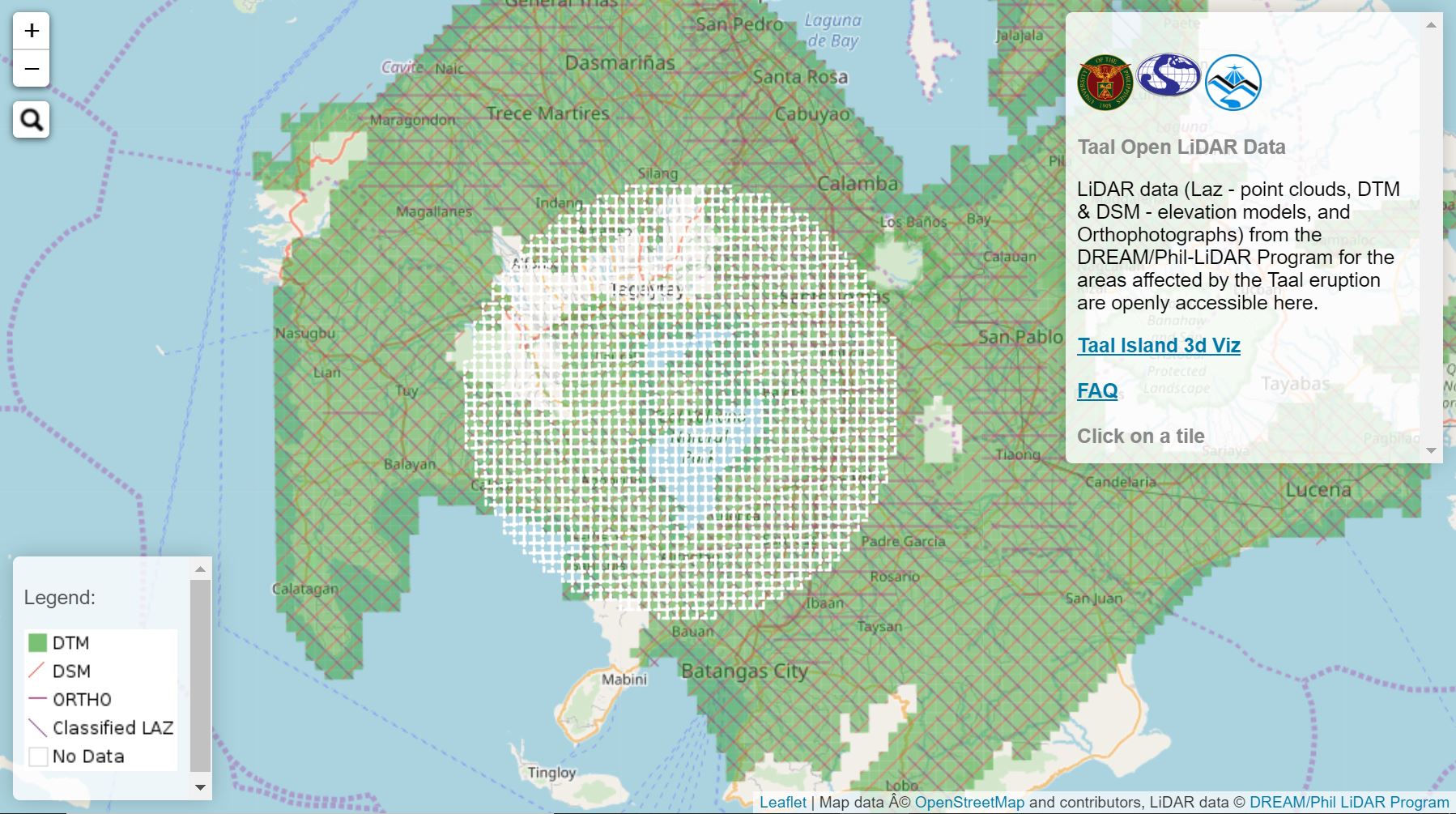
Screenshot of LiDAR portal.
The UP TCAGP’s Disaster Risk and Exposure Assessment for Mitigation (DREAM) and PHIL LiDAR program generated data from 2014 – 2017.
“This allows anyone who wishes to utilize the data, e.g. planning and reconstruction, for their specific scientific research purposes (the use of the data for disaster risk reduction and resource management is highly encouraged) provided that proper citation will be given to the UP TCAGP and PHIL-LIDAR Program as the source of the data. Please note that while stringent QA/QC protocols were in place during the program operation, we cannot guarantee that the data is free of discrepancies, bugs or defect,” the UP TCAGP report said.
In its report FAQs, the team notes that the LiDAR data from the DREAM/Phil-LiDAR Program (Laz, DSM, DTM, and Orthophotographs) are within 20km from the Taal crater. Due to data cleaning and vetting purpose, the team will be staggering the release of the data starting from DTM and DSMs first, then Laz data for volcano island, 14km, 17km, then 20km radius.
The UP institution says its open data policy on Taal Volcano is in line with its mandate to provide training and research services on geomatics. The open data policy was made possible with the concurrence of the UP, the UP Office of the Vice-Chancellor for Research and Development, the Department of Science and Technology, DOST PCIEERD, and Mapua University.
The Phil-LiDAR researchers generated the datasets from 2014-2017. The web map interface, data cleaning, checking, and preparation were done by volunteer work by current and former researchers from UP TCAGP namely, Benjamin Dag, Benjamin Jiao, Benjamin Magallon, Cham Mamador, Ian Panganiban, Julius Sempio, Rk Aranas, and Rodel Ismael.
University of North Carolina Portal using UP LiDAR

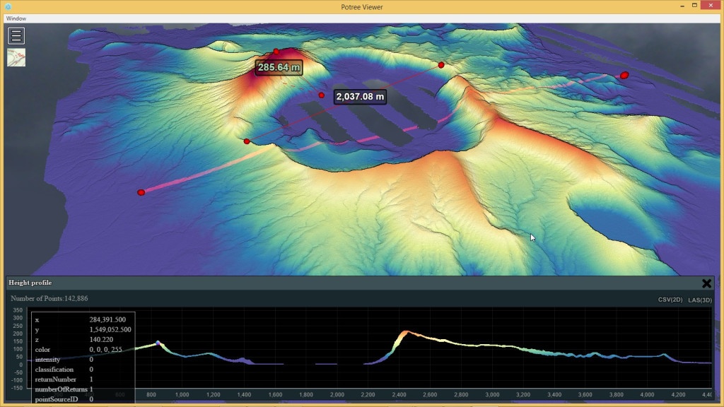
Screenshot of Taal Volcano on Potree released by Prof. Martin Isenburg.
Dr. Martin Isenburg, formerly of the Department of Computer Science at the University of North Carolina at Chapel Hill, praised the University of the Philippines for being the first in Asia with an open data policy and released an interactive portal using the UP LiDAR on Taal Volcano. Dr. Isenburg, now the CEO of rapidlasso GmbH makers of the software LAStools and the LiDAR compressor LASzip that are used by UP, earlier challenged the Philippines to have an Open Data Policy for LiDAR datasets not only for Taal but for the entire country.
Access the Interactive Portal of Martin Isenburg’s LAStools hosted at the University of North Carolina here.
UP LiDAR for Educational Material
University of the Philippines scientist Dr. Mahar Lagmay, of the state university’s Resilience Institute, also used the UP LiDAR to come up with another of his animated infographics educational series for Twitter University/Facebook University.
Dr. Lagmay told Good News Pilipinas that he welcomes the “challenge to Open the Data for LiDAR as it is necessary for the country’s disaster risk reduction efforts and not just for Taal.”
Access the UP LiDAR Data here.
The University of the Philippines has collaborated on several ground-breaking studies resulting in technology milestones for the Philippines, among them, the Diwata 1 and Diwata 2 Microsatellite projects that preceded the creation of the Philippine Space Agency and another UP Diliman experiment that won 1st place in the Space Mission Idea Contest in Japan.
Want to know how to be a Proud Pinoy? Like, Follow, Subscribe to GoodNewsPilipinas.com and our socials Facebook, Twitter, Instagram, Good News Pilipinas! TV on YouTube, for new story notifications and e-mail newsletters for updates on more Filipino Pride stories.